Soil erosion by water
On this page
Water erosion (erosion) is the detachment of soil particles caused by rainfall and surface runoff, leading to their transport across the ground surface. On croplands, erosion is influenced by factors such as land topography, climate and weather conditions, vegetation cover, soil type, soil structure and organic matter content, tillage practices, and drainage systems.
Erosion has a significant impact on surface water quality and aquatic ecosystems. Soil particles transported to water bodies carry phosphorus, which contributes to eutrophication. Additionally, soil deposition in water bodies causes turbidity and sedimentation. Erosion also results in the loss of topsoil, nutrients, and carbon from farmland, as well as changes in soil structure, composition, and surface features, ultimately reducing soil productivity.
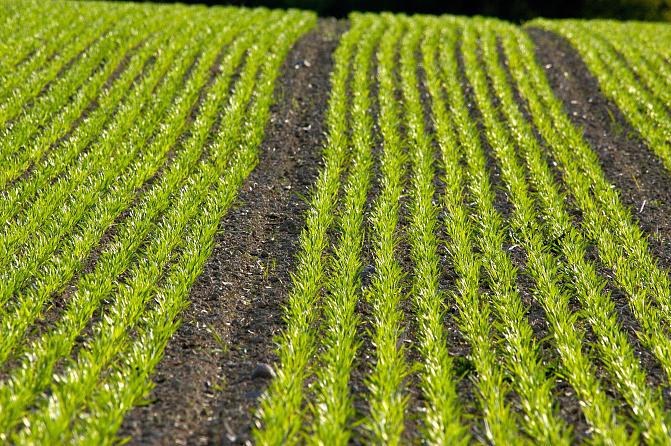
The harmful effects of farmland erosion can be mitigated through measures such as winter vegetation cover and establishing buffer zones along slopes adjacent to water bodies. Direct seeding, reduced tillage methods, and increasing the organic matter content in the soil also reduce erosion.
In Finland, cropland erosion has been assessed at the national level using the RUSLE model (Revised Universal Soil Loss Equation) (Räsänen 2024), which estimates erosion under long-term average climate and weather conditions. The model calculates the amount of soil detached and transported from the soil surface within grid cells (2 m × 2 m) but does not estimate the quantity of soil reaching water bodies. The national assessment utilized field-specific crop and management data from the Finnish Food Authority for 2023. The crop data included 180 different crops, and the management data provided information on the implementation of winter vegetation cover (genuine vegetation cover, stubble, reduced tillage, plant residues, and no vegetation cover). The impact of winter vegetation cover on erosion was evaluated by comparing calculated erosion rates with and without vegetation cover.
According to the assessment, the average cropland erosion in Finland was 570 kg/ha per year, with municipal-level variation ranging from 120 to 1760 kg/ha per year. The total erosion from all croplands exceeded 1.3 million tons annually. Winter vegetation cover was estimated to reduce erosion nationwide by 50% (44–56%) compared to a scenario without winter vegetation cover. At the municipal level, the erosion-reducing effect of vegetation cover ranged between 21% (18–24%) and 61% (54–70%). The effectiveness of winter vegetation cover in controlling erosion was lowest in several coastal municipalities in Western, Southwestern, and Southern Finland. Furthermore, winter vegetation cover was not specifically targeted at municipalities with high erosion rates and extensive cropland areas. Nevertheless, the estimates highlight the significant role of winter vegetation cover in erosion control.
The assessments are computational and inevitably involve uncertainties. However, RUSLE provides results in Finland that are comparable in accuracy to those in other regions worldwide. The latest results are also not fully comparable to earlier assessments in Finland, particularly regarding the absolute magnitude of erosion, due to updates and changes in the background data used in the model.
Note: The 2019 and 2023 erosion estimates in the database table are not fully comparable due to changes and updates in the background data used in the estimates. The erosion estimates for 2023 are therefore slightly higher than those for 2019.
Allow functional cookies to show the embedded graph.
Data collection
Description of the indicator
Soil erosion by water on croplands is one of the impact indicators in the European Union's Common Agricultural Policy (CAP). This indicator is used to estimate the magnitude of water erosion and to monitor the effectiveness of measures aimed at preventing erosion. The indicator related to water erosion has been calculated by the Natural Resources Institute Finland (Luke) using the widely applied RUSLE model (Revised Universal Soil Loss Equation). The model estimates long-term average erosion based on precipitation in the unit of tons per hectare per year.
In this context, erosion refers to the amount of soil detached and set in motion from the soil surface. The indicator does not account for annual weather variability or the amount of soil reaching water bodies, although it provides indirect indications of this.
The indicator is a common CAP plan impact indicator I.2 as set out in regulation (EU) 2021/2115, Annex I. It is used in all Member States.
| Soil erosion by water in Finland | Year | ||
|---|---|---|---|
| 2019 | 2023 | ||
| Total arable land area (in erosion evaluation) | 2 325 398 | 2 256 850 | ha |
| Average erosion at arable land (with crops and management of the year) | 0,43 | 0,57 | t/ha/yr |
| Arable land area with erosion rate >5 t/ha/yr | 45 156 | 18 845 | ha |
| Arable land area with erosion rate >10 t/ha/yr | 9 992 | 3 816 | ha |
| Arable land area with erosion rate >5 t/ha/yr of total arable land area | 1,9 | 0,8 | % |
| Arable land area with erosion rate >10 t/ha/yr of total arable land area | 0,4 | 0,2 | % |
